
If you’ve flown over a farm lately and spotted a drone darting between rows of crops, snapping photos or hovering to capture heat signatures, you might have wondered: how exactly does that little flying machine tell when a plant is missing key nutrients? As someone who’s spent the last five years supplying agricultural drones to small family farms and large commercial operations alike, I’ve seen this technology transform how growers spot nutrient deficiencies—no more walking 10 miles a day with a soil test kit, no more guessing which patch of corn is stunted. It’s all about combining on-board sensors, data analytics, and a deep understanding of plant physiology to turn drone-collected data into actionable insights.
Let’s start with the basics. Plants get their nutrients from three main sources: soil, water, and air. Deficiencies show up differently depending on the nutrient—some cause yellowing leaves, others stunted growth, some even alter the temperature of the plant itself. A agricultural drone doesn’t just “see” color like the human eye does; it uses specialized cameras and sensors to pick up details we can’t, which is where the real magic happens.
Visible light cameras, for example, detect changes in leaf color. Chlorophyll, the green pigment in plants, is responsible for photosynthesis—and it relies on nitrogen, one of the most common nutrients crops need. When a plant is low on nitrogen, chlorophyll breaks down, turning leaves a pale yellow or even light green instead of deep, vibrant green. A drone’s RGB (red, green, blue) camera can measure the intensity of green light reflected by the leaves, and feed that into a normalized difference vegetation index (NDVI) calculation. NDVI is a simple formula that compares the difference between near-infrared light (which healthy plants reflect heavily) and red light (which they absorb). A low NDVI score tells us that a crop patch has less chlorophyll, almost certainly pointing to a nitrogen deficiency. But here’s the catch: RGB cameras can only spot obvious, late-stage deficiencies. By the time leaves turn yellow, a crop has already lost significant growth potential. That’s where other sensors come in.
Thermal imaging is a game-changer for early detection, and it’s why we stock a Thermal Imaging Agricultural Drone for customers who want to catch problems before they’re visible to the naked eye. Thermal sensors measure the surface temperature of plants, right down to a fraction of a degree. When a plant is healthy, its stomata (tiny pores on leaves) are open, allowing it to transpire—release water vapor—which cools the leaf’s surface. If a plant is missing key nutrients like phosphorus or magnesium, its stomata close to conserve resources, and the leaf temperature rises. This temperature difference is subtle, but a thermal camera can pick it up even before color changes appear. Last year, a wheat farmer in Kansas used our thermal drones to spot a magnesium deficiency in a 2-acre patch of wheat 10 days before the rest of the field showed symptoms. They applied a targeted foliar spray, instead of covering the entire field, saving hundreds of dollars in fertilizer and preventing a 15% yield loss. That’s the kind of ROI we talk about when we explain how these drones work beyond just spraying.
Another key tool is multispectral sensors, which capture light in bands beyond visible red and near-infrared—like red edge, a narrow band between red and near-infrared that’s extra sensitive to plant stress. The red edge reflectance index (REI) is particularly useful for detecting deficiencies in iron, zinc, and other micronutrients that RGB cameras miss. Micronutrient deficiencies often cause unique stress responses: iron deficiency, for example, leads to interveinal chlorosis (yellowing between leaf veins) in young leaves, while zinc deficiency causes rosetting (stunted, clustered growth) in corn. Multispectral sensors pick up the unique spectral “fingerprint” of these deficiencies, which data analytics software then maps to exact locations on the field.
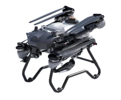
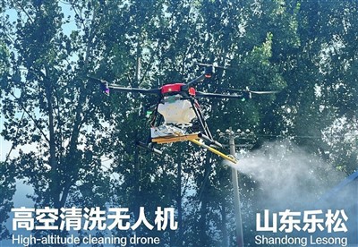
Once the drone collects all this data, it’s not just a pile of photos—we use cloud-based agronomic software to process it. The drone’s GPS pins every data point to a specific location on the farm, so you get a heat map (often called a nutrient deficiency map) that shows exactly where crops are stressed. This is where our spraying drones become incredibly valuable: instead of driving a tractor over every inch of the field, you can use the map to only spray the deficient areas. Our Spraying Drone for Farm models, like the 10L Agricultural Drone, can carry enough liquid fertilizer or foliar nutrients to cover 10 acres on a single battery charge, and their precision spraying system targets only the stressed plants, reducing waste by up to 70% compared to traditional broadcast spraying. We also have a 20L Spray Drone for larger operations, which can cover twice that area in the same flight time, making it ideal for farms over 500 acres.
It’s important to note that drone technology doesn’t replace soil tests or expert agronomic advice—it complements them. Soil tests tell you what’s in the ground, but a drone tells you what the plant is actually taking up. Sometimes a soil test shows enough nitrogen, but a compacted layer in the soil is preventing the plant’s roots from accessing it, leading to a deficiency. Drones pick up that above-ground stress, so you know to address soil compaction, not just add more fertilizer. For corn growers, in particular, our Corn Seeding Drone can even be calibrated to plant cover crops in the deficient areas, improving soil health for future growing seasons.
We’ve worked with hundreds of farmers over the past three years, and the question I get most often is: “Can this technology really be that accurate?” The short answer is yes—when calibrated properly. The key is to fly the drone at the right time of day, under consistent lighting conditions, and with a clear understanding of each crop’s nutrient needs. For example, corn has a high nitrogen requirement during the vegetative growth stage, so flying our drones during V6-V8 growth (when corn is knee-high) gives the most reliable nutrient deficiency data. That’s why we provide custom flight plans and agronomic training with every drone we sell, so our customers don’t just buy a piece of equipment—they know how to use it to solve their specific farm problems.
Another common misconception is that agricultural drones are too expensive for small farms. In reality, the ROI is often faster than you think. A 5-acre family farm in Iowa used our Thermal Imaging Agricultural Drone last growing season to spot a potassium deficiency in their soybean field. Instead of applying $1,200 worth of broadcast fertilizer, they applied $300 worth of targeted foliar spray, and their yield increased by 8% in that patch—enough to pay for the drone in a single season. For farms of all sizes, the ability to be precise with nutrients reduces input costs, boosts yields, and is more sustainable, too.
Of course, there are limitations. Drone data can be skewed by factors like cloud cover, high winds, or even dust on the camera lens, so it’s important to follow best practices for flight operations. Also, some nutrient deficiencies have similar spectral fingerprints, so combining drone data with leaf tissue tests (taken from the exact locations identified by the drone) ensures you’re making the right treatment. Our team always recommends pairing drone monitoring with regular leaf sampling, and we offer partnerships with local agronomists to help our customers interpret their data correctly.
Looking ahead, we’re constantly improving our drone technology to make nutrient detection even more precise. Next year, we’re launching a new model with hyperspectral sensors, which capture hundreds of light bands to pick up even more subtle nutrient stress signals. But even with current technology, the ability to detect nutrient deficiencies early and target treatments is one of the most impactful uses of agricultural drones today.
If you’re a farmer looking to reduce input costs, boost yields, and take the guesswork out of nutrient management, our team can help you find the right drone for your operation. Whether you’re a small farm looking for a compact 10L Agricultural Drone or a large commercial operation needing the capacity of a 20L Spray Drone, we have solutions tailored to your needs. Don’t hesitate to connect with us to discuss your farm’s specific goals and how our drone technology can help you achieve them.


References
- Mulla, D. J. (2013). Twenty five years of remote sensing in precision agriculture: Key advances and remaining knowledge gaps. Biosystems Engineering, 114(4), 358-371.
- Sakamoto, T., Gitelson, A. A., & Arkebauer, T. J. (2012). Remote estimation of leaf chlorophyll content in maize and soybean using red edge reflectance indices. Agronomy Journal, 104(3), 778-786.
- Jones, H. G. (2004). Plants and microclimate: A quantitative approach to environmental plant physiology. Cambridge University Press.
- Zhang, C., & Kovacs, J. M. (2012). The application of small unmanned aerial systems for precision agriculture: A review. Precision Agriculture, 13(6), 693-712.