Basic meaning
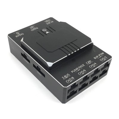
Infrared thermal imaging monitoring drone is an intelligent flight device equipped with an infrared thermal imaging pan tilt camera, combined with visible light cameras, positioning and data transmission systems.
It does not rely on visible light and can passively capture the infrared thermal radiation emitted by objects, convert temperature differences into visualized thermal images, and achieve all-weather, non-contact temperature monitoring, hidden danger investigation, and target recognition. It is a specialized equipment for intelligent aerial inspection and monitoring.
Core Features
Work 24/7
Not limited by night, heavy fog, smoke, or low light environments, it can work normally both day and night, making up for the blind spots of manual and ordinary aerial drones at night.
Penetrating interference, covert identification
It can penetrate smoke, thin fog, and slight obstruction, accurately detect hidden heat sources, hidden fires, and hidden ignition points, and can identify hidden dangers that cannot be observed by the naked eye or ordinary cameras.
Accurate temperature measurement and temperature difference perception
Equipped with a high-precision temperature measurement module, it can detect the temperature of the area in real time, generate a heat map, quickly locate high-temperature abnormal points, and accurately determine faults, overheating, and fire hazards.
Flexible mobility and wide coverage
Flight operations are not limited by mountains, steep slopes, complex buildings, or remote areas, with convenient takeoff and landing, fast inspection speed, and large-scale rapid scanning, greatly improving inspection efficiency.
Safe, efficient, and risk reducing
Remote aerial monitoring eliminates the need for personnel to enter high-risk areas, avoiding safety hazards caused by high altitude, high temperature, flammability and explosiveness, and complex outdoor environments.
Intelligent data analysis
Real time image feedback, video archiving, and AI algorithm automatic labeling of high temperature points, over temperature warning, and data retention for easy traceability and normalized management.
Main application scope
Fire Protection Forest Fire Prevention Field
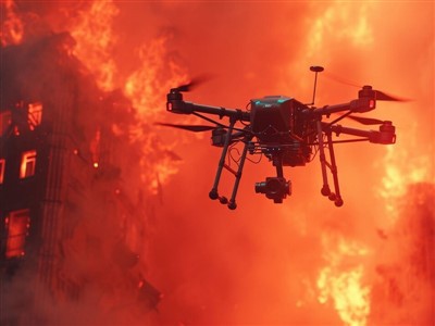
Daily fire prevention patrols in forests and grasslands, quickly identifying smoke points, hidden fires, and underground fires; Penetrating thick smoke in the fire scene, locking the range of the fire line and residual fire points to prevent reignition.
Power facility inspection
High voltage transmission lines, towers, substations, and photovoltaic power stations are inspected to identify potential electrical hazards such as line aging, equipment overheating, joint heating, and component failures.
Industrial safety production
Temperature monitoring of chemical plants, storage silos, pipelines, and storage tanks to promptly detect equipment overheating and material self ignition hazards; Fire and explosion safety inspections in the factory area.
Urban and Building Monitoring
Detection of hidden dangers on the exterior walls of high-rise buildings and damage to the insulation layer on the roof; Investigation of old residential areas and illegal constructions; Inspection of spontaneous combustion hazards in urban garbage dumping sites.
Emergency rescue and search and rescue
In flood, landslide, and field rescue operations, relying on human heat sources to quickly search for trapped and missing individuals.
Agriculture, Forestry, and Environmental Monitoring
Monitoring of crop diseases and pests in farmland, temperature measurement of the breeding area environment; Investigation of high temperature and odor points in rivers and landfills, and normalized supervision of the ecological environment.
Hot Tags: infrared thermal imaging monitoring drone, China infrared thermal imaging monitoring drone manufacturers, factory, Digital Zoom Drone, small monitoring andexploration drone, Infrared Thermal Imaging Monitoring Drone, Radar Reconnaissance Drone, Thermal Imaging Drones